7th Infantry Division Campaign Map
From Arctic fog in the Aleutians to Okinawa’s southern hills, the Hourglass Division fought across the Pacific island war.
Size:
24 x 18
7th Infantry Division Campaign Map
If you have any questions, you are always welcome to contact us. We'll get back to you as soon as possible, within 24 hours on weekdays.
-
Shipping Information
Use this text to answer questions in as much detail as possible for your customers.
-
Customer Support
Use this text to answer questions in as much detail as possible for your customers.
-
FAQ’s
Use this text to answer questions in as much detail as possible for your customers.
-
Contact Us
Use this text to answer questions in as much detail as possible for your customers.
7th Infantry Division Campaign Map
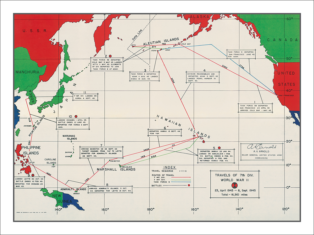
The 7th Infantry Division’s World War II route began in one of the war’s most unusual combat environments. The Hourglass Division first saw action in the Aleutians, landing on Attu in May 1943 amid fog, cold, and difficult tundra terrain. There, its regiments fought through Japanese positions around passes, ridges, and harbor approaches before organized resistance collapsed at the end of the month. A later landing on Kiska found that Japanese forces had evacuated the island.
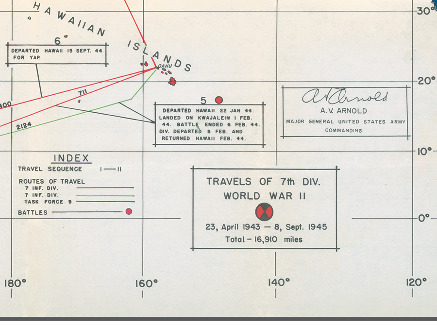
After the Aleutians, the division trained in Hawaii and shifted to the central Pacific. In January 1944, it landed in the Marshall Islands and fought for Kwajalein Atoll, helping secure a key stepping stone in the advance across the Pacific. Later that year, the division moved to the Philippines, landing at Leyte in October and fighting through airfields, road corridors, and Japanese counterattacks as Allied forces worked to secure the island.
Its final major campaign came on Okinawa. Landing on April 1, 1945, the 7th Infantry crossed the island in the opening advance before being drawn into the prolonged battle against Japanese defenses in the south. The map shows a campaign that stretched from the frozen Aleutians to the central Pacific and the last great land battle of the war.
PAPER & PRINTING
Printed on archival-grade, acid-free matte fine-art paper with a natural surface for crisp detail, accurate color, and lasting display quality.